Showing posts with label Fastpack. Show all posts

Wednesday, February 17, 2016

FidEgan's FastPacks - Episode 10 - Tierra del Fuego - running at el Fin del Mundo


John and Kathleen are currently on a world trip where we plan to pursue our passion of trail running through the various landscapes and environments of the world. As we pass through each country we want to post our top pick for a trail run (or hike) that we did. This does not mean that this is the best trail to run in that country. It just means that it was our favorite that we did. We are both using Ultraspire Epic Fastpacks to carry our gear, hence the name of the column.

Where: Glaciar Vinciguerra, outside town of Ushuaia, Island of Tierra del Fuego, Argentina
Facilities/Trailhead: No facilities. The trailhead is about 10km outside of Ushuaia at Turbera Valle Andorra. A taxi is the easiest way to get there for about 130 Argentine pesos (~$9). We hitchhiked to get back but this may take walking down the dirt road for a bit. 
Fees: Free besides transportation costs to get there.
Terrain/Trials: This ended up being a combination of a run and a hike. There are very flat and rolling sections good for running and very steep sections that we had to hike.  The trail is marked by orange and blue markers.
Trail markers on trees                           
 
Distance: 13km
Description: We had run in the Tierra del Fuego National Park the day before and enjoyed these trails a lot more. The park is a bit of a scam between the high prices the minivans charge to get there and the park entrance fee. The trails in the mountains north of town are more scenic and free so we would recommend going there. 

This trail starts at the end of the road at Turbera Valle Andorra which is a peat cutting operation. The gate says in Spanish “No entrance” but it is referring to cars. It is permitted to walk across their property, just make sure to close the gate behind you. Follow the road a couple of hundred meters and then go left when a trail/secondary road breaks off. If you reach the buildings you went too far. 
Peat cutting farm in front, glacier in back
 

The first 2 km is along a pretty flat section as you pass through areas of cut bog with a gentle river flowing to your right. The trail is marked by yellow stakes and is obvious as you cut across the fields. This was a great section to run through. This eventually led to a bridge that crossed the river where the climbing began. 
Riverside running                                  
 

There are numerous muddy sections where log boardwalks have been built. Better for twisting an ankle on then running.
Log boardwalk after crossing bridge    

This led up to the first steep hill which was a series of switchbacks that led up to a trail intersection. For an added bonus the right trail goes up to Laguna Encantada which would add another hour or more to the experience. Going to the left continues on to Laguna de la where the trail alternates between runnable traverses across the hillside and steep uphill sections. 
Uphill section                                     

Eventually it leads up to where the Rio de Leche is flowing out of the lake. There is a flat area where beavers have built two dams and a large lodge. 
Beaver flats with snow rainbow       

From this flat section of terrain it then becomes steep glacial moraine up the last section to get to the lake. 
Last climb to the lake                     

Despite being late summer here (the equivalent of August) it was snowing sideways with a bitter wind, while at the same time it was sunny, and behind us a rainbow could be seen lower in the valley. Be prepared for every weather imaginable when hiking/running in Patagonia. 
We had to hold each other to stay warm
 

It was a quick trip back down the hill. The guide books say that the hike should take 5 to 6 hours round trip but with running the parts we could the trip took us just over 3 hours with a quick lunch break. We were also told that from the same trailhead there is a 31 km trail that crosses Paso de la Oveja that would make a great trail run but at the same time they said that camping at the lake near the Pass was really worth it so it might make a good backpack/fastpack also.

Thursday, May 14, 2015

FidEgan's Fastpacks - Episode 9 - Reaching the high point of Malawi


John and I are currently on a world trip where we plan to pursue our passion of trail running through the various landscapes and environments of the world.  As we pass through each country we want to post our top pick for a trail run that we did.  This does not mean that this is the best trail to run in that country.  It just means that it was our favorite that we did.  We are both using Ultraspire Fastpacks to carry our gear, hence the name of the column.  On this trip John carried his larger backpack to carry more gear while I used my Fastpack.

Due to an unfortunate error while (attempting to) download our pictures they were accidently deleted. 

Where:  A traverse of the Mount Mulanje massif in southern Malawi right on the Mozambique border.
Mount Mulanje massif (Google images)
 
Facilities/Trailhead:  We started our hike from the Likhubula Forestry Office/Park Entrance.  We hiked out at Fort Listers Gap which was just a small farming village with no park facilities there.  It took a half day of mini-buses to get to the Likhubula Forestry Office from the city of Blantyre.  We were very lucky to have hitched a ride out of Fort Listers Gap.  This village is on a very rough dirt road and is a long way from any public transportation.  Once you reach the town of Phurumbu it is still a half day of mini-buses to get back to Blantyre.

Fees:  The park entrance fee is only 100 Kwacha (22 cents) per person.  A local guide is required in the park and the government set rate is 11,000 Kwacha (~$25) per day.  Porters hire out for 8000 Kwacha (~$18) per day.  There is a choice of using the huts or camping.  Even when camping you are free to use the hut to cook dinner in.  Camping was 500 Kwacha/person/night.  Our experience has been that huts tend to be crowded and noisy so we elected to bring our own tent.  We were glad we did as it provided both privacy and a better barrier against bugs at night. 

Terrain/Trials:  There is a network of trails that intersect between all the huts scattered around the massif with trails that come up from the various villages around the mountain.  A trip from one day to over a week could be arranged depending on how long you would want to hike there.  There are also a number of peaks on the top of the massif that can be climbed.  These range from walk ups to technical rock climbing to get to the top of. 

Distance:  We never saw a map with distances so are not sure about the actual number of kilometers covered.  We did hike 4 hours the first day, 8 hours the second day (5 of those were going up and down Sapitwa Peak), 8 hours the third day, and about 3 hours the last day (though without a ride it could have been many hours more).

Description:  The guide we had found in Blantyre was named Fanuel and he ended up being great.  He was born and grew up at the foot of the mountain and is now very active in the Blantyre Mountain Club.  He often climbs there just for fun and has been up most of the peaks including the technical ones.  He is an orphan and the eldest of all his brothers and sisters.  He is supporting his entire family along with 4 Mozambican orphans (one of which is blind) trying to get them through school.  We highly recommend him as a guide and we hired his brother Victor as a porter.  It is possible to contact him via phone (0999329808) or email (fanueljarson@yahoo.com).  Other guides can also be found in the town of Mulanje.
Our mountain goat guide Fanuel
     There are several trails from the Likhubula Forestry Station to the top of the escarpment.  As usual we chose the shortest but steepest way called the Skyline Trail.  At the base of the mountain are verdant green tea plantations and most of the mountain is steep rock cliffs that go up to the upper plateau.  The lower elevations tend to be hot and the clay soil makes it very slippery if there has been any recent rain.  A variety of birds and vervet monkeys could be seen in the trees.  There were leopard here at one point but none have been seen for many years.  Once on the upper plateau there is an entire new mountain range on the top.  A variety of mountain summits stick up with valleys and ridgelines in between them.  We spent the first night at Chambe Hut and this was the only night where there were other tourists around.  The amount of stars visible at night was stunning. 

Day 2 involved hiking 3 hours to Chisepo Hut.  We left our packs and Victor at the hut while the rest of us hiked to the top of Sapitwa Peak which is the high point of Malawi.  It is not technical to summit but it is steep in places and scrambling across rocks and ledges is required.  Starting early in the morning is recommended as in the afternoon the view is often obscured by clouds.  From the top there are extensive views over the plains into Mozambique.  Some people have been known to camp on this summit.

Day 3 was a long day and we were tired from the previous days effort.  We hiked to Sombani Hut but the nice thing was that there were 2 other huts along the way which provided good places to stop and take a break.  The day consisted of a series of climbing up and over a ridgeline and then across a valley with a river marking the low point of the valley.  Many of these rivers had inviting looking swimming holes in them.  On each day we had come across multiple villagers poaching cedar logs out of the forest but on this day we saw the most. 
One of the many swimming holes (Google images)
Day 4 was a short day of hiking back down the mountain to the plains to a village called Fort Lister Gap.  In 1893 the British built a fort there to try to end the slave trade caravans that were moving between Malawi and Mozambique.  It was a easy and scenic hike.  We were lucky once we hit the rough dirt road in Fort Lister we were able to find someone with a car that gave us a ride.  Without that it would have been a very long road hike or ride on a bike taxi to get to the town of Phurumbu where mini-bus transport can be found back to Blantyre. 

A wide variety of trails are on the mountain.  Day hikes or overnight trips are possible.  With a week or more pretty much the entire upper mountain could be explored.  There are also a number of different mountains that could be climbed of varying difficulty.  It was a beautiful place and the locals could use all the tourist money they can get.  The more tourists that visit places like this, the more likely those places will be protected by both the government and the local villagers. 

Monday, November 24, 2014

FidEgan's FastPacks - Episode 8 - The Lycian Way - Turkish Hiking, History, and Hospitality


John and I are currently on a world trip where we plan to persue our passion of trail running through the various landscapes and environments of the world. As we pass through each country we want to post our top pick for a trail run that we did. This does not mean that this is the best trail to run in that country. It just means that it was our favorite that we did. We are both using Ultraspire Fastpacks to carry our gear, hence the name of the column.

In this case this we did this trail as a backpack. It theoretically could be done as a Fastpack but because we are currently living out of our backpacks, and it's a point to point trail, we elected to carry all of our gear and full camping equipment and take our time as we moved along the coast. It was just easier that way.
One of many incredible sunsets

Where: A hiking trail that follows the southern coast of Turkey between the cities of Fethiye and Antalya. Most people hike this trail in the spring, but fall is another popular time. Summer is too hot and during the winter the upper terrain is covered in snow.

Facilities/Trailhead: The trail ends are in the villages of Ovacik in the west and Geyikbayiri in the east which are close to the towns of Fethiye and Antalya, respectively. There are many towns and villages along the route that have bus and dolmus (minibus) service so shorter sections of the trail can be easily hiked. For the entire length of the trail with the exception of two sections in the eastern mountains there are pensions and hotels you can stay at. Sometimes this means catching a dolmus at the end of the day to get into town but you could do the majority of this trail without camping gear. However, if you have a tent and cooking gear then the variety of camping spots is vast. Water is the only limitation when it comes to camping as this region is very dry. Many of the cisterns and water sources along the trail are less than ideal. If you camp then you absolutely will want a water filter (not just water purification tablets). Camping fuel is also a difficult find. White gas or butane canisters might be able to be found in Fethiye or Antalya, but not easily. A Whisperlite International that burns gasoline would be a good choice. 
Kabak Beach pension    
Camping amongst ruins

Fees: There is no cost involved with hiking the trail itself except for at Chimaera and Guynuk in the eastern end of the trail.  There the trail passes through "park" areas that charge a few dollars for entry.  If you are going east to west there would be a charge to enter Olympos but going the other way you enter the area from the mountains were there is no entry gate.  Staying in pensions ran in the 70 to 120 Turkish Lira range per night (~$30-$55) for two people. Eating in restaurants usually cost about 15-20 Lira ($7-9) for an entree. The food in Turkey is amazing, one of many things we will miss about this country. Word of warning about this trail – the availability of ATMs along it is sparse. Have plenty of cash on hand so that you don't run out in the middle of the trail (like we did) which involves a day of riding buses for hours to get to a money source.

Terrain/Trails: The trails runs the gamut of terrain types. From goat paths, to single track trails, sandy beaches, Lycian and Roman roads that are worn smooth by 3000 years of feet and hooves on them, to dirt and paved roads. Much of the smaller trails are covered with fist size rocks that would probably make running on the terrain (for many) painful. The trails are marked by yellow signs and red/white paint hashmarks. For the most part the trail is well marked and if you go more then 200 meters without seeing a marker then you need to start looking around. Many days we would miss a marker or turn but would quickly realize it. There is some trail rerouting going on Gurses and Demre which is the only area where we really got lost. Part of our problem was that we had an old edition of the guidebook and map. Having the current edition with the latest updates probably would have solved that problem.
Sign trail markers 
Paint trail markers

Distance: The trail runs for over 500km (300+ miles) along the coast and coastal mountains of southern Turkey. The guide books describe hiking the trail over a 30 day period. We took 38 days as we would find a scenic beach or town and not want to leave. It was refreshing not to have to make a deadline as there are some incredible spots along the coast that warrant a longer stay.

Description: This trail has a huge amount of the three things we like best about Turkey – hiking, the history, and the hospitality. The hiking is gorgeous. Sometimes you are at sea level walking along the beach. At other times you are at 5000+ feet with panoramic views. Every corner we went around there was a new sight or perspective to see. The history along the trail is like nowhere else we have ever seen. Layer after layer of history going back 3000 years just lying in the bushes everywhere as we walked along, from the early Lycians who fought against Greece in the Trojan War, to Persia, Alexander the Great, Romans, Byzantine, the Crusades, the Ottoman Empire, and now theTurkish Republic. There are all types of ruins and buildings all along the trail: Lycian tombs, remnants of cities, Roman amphitheaters, baths, and aqueducts, some of the first ever Christian churches, forts built by Christian Crusaders, Ottoman era cisterns, and statues of Ataturk line the path that we hiked. It was a rare day that went by without passing some piece of history. 
Trail is a Roman aqueduct
Roman aqueduct Delikkeer
Statues of Ataturk abound  
After several earthquakes some of the ruins are now under the ocean where you can swim or kayak over them. Turkish hospitality like most Muslim hospitality we have met cannot be beat. Strangers would invite us to stop and have tea, bread, and olives with them. People would pick apples, pomegranates, and grapes and give them to us as we hiked by their homes. The Turks would also be very helpful as we moved along the trail. Many times as we left one village we were told that their friends in the adjacent village would be ready to receive us once we got there; “it is only a phone call away”, they'd say. The one warning we would offer for those considering this trail is to beware if you are allergic to bees or have a fear of snakes, or dogs. This region is known for its honey making, especially in the western part of the trail closer to Fethiye. There were thousands of bee hives that we passed so often you could hear the trees buzzing with them, and some of the water sources are overwhelmed by them. The bees seemed fairly docile, however, so as long as you don't freak out they will not bother you. John did get stung once in the ankle when one got caught between his foot and shoe but that was a freak occurrence. 
Cluster of bee hives
We saw multiple snakes. None of the ones we saw were poisonous, though they do exist here. Most were grass snakes which are harmless as was the Whip Snake we saw. However, the Whip Snake was very large (~6 feet) and moved super fast (faster then we could run) which was a little unnerving. Probably the biggest threat was all the dogs, especially the sheep dogs guarding their flocks. Many were just noisy and were scared to come close but there were a few that were downright aggressive and had to be chased off with our hiking poles. We were warned by several Turks that these dogs can be dangerous, especially at night. 
View over Olu Deniz
Canyon to Alinka
Leto Temple, Letoon
Letoon Amphitheater
Harpy Tomb, Xanthos
Amphitheater, Xanthos
Tombs with Arch of Modestus
Genoese fort, Simena              
Ucagiz Bay                             
Medusa, Myra                        
Tombs in Myra                      

If you enjoy eating excellent food, good hospitality and hiking all day through ancient history then this trail might be for you. There is a reason it was voted on the World's Ten Best Walks.


Monday, September 29, 2014

FidEgan's FastPacks (or not so fast) - Episode 7 - The GR 20, Corsica, France

John and I are currently on a world trip where we plan to persue our passion of trail running through the various landscapes and environments of the world. As we pass through each country we want to post our top pick for a trail run that we did. This does not mean that this is the best trail to run in that country. It just means that it was our favorite that we did. We are both using Ultraspire Fastpacks to carry our gear, hence the name of the column. On this trip we had our Fastpacks for the side trip we did but for the main trail full size backpacks were needed for all our camping gear.

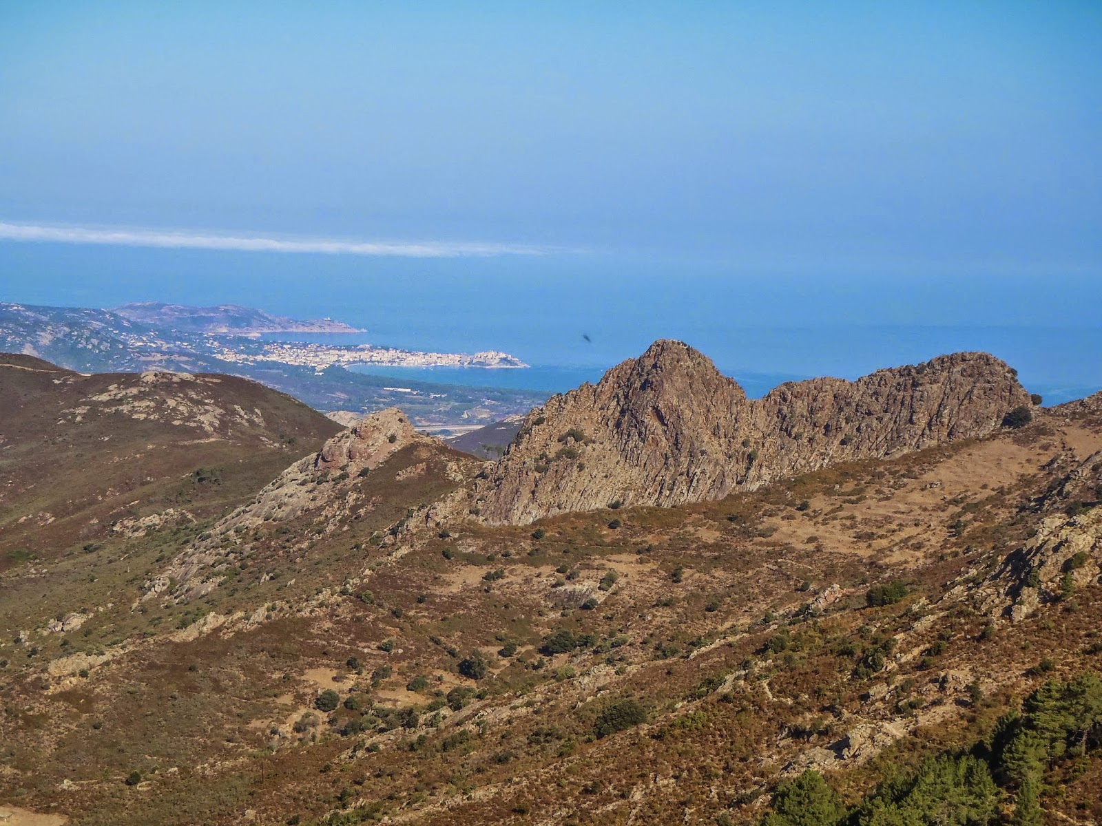
Where: The GR 20 hiking trail which traverses the island of Corsica from north (Calenzana) to south (Conca).
Map from Wikipedia
 
Facilities/Trailhead: The trail is split into a northern and southern section with the village of Vizzavona being considered the middle point. In the north the town of Calvi can be reached by train or bus. A bus or taxi will be needed for the last ~10km to get to the trailhead in Calenzana. The southern terminus in Conca can be reached from the town of Porto Vechchio by bus. Vizzavona has a train station which is the best way to get there. There are some supplies available in each of these towns but it will be cheaper (and better selection) if you stock up on any supplies you need in the larger towns. Have enough money with you. They take cash only and the nearest ATM is an hour train ride from Vizzavona in the town of Corte.

There are Refuge mountain huts where you can stay or camp. Camping is only legally allowed at the Refuges. It takes between 5 and 9 hours of hiking between the huts. During the summer months there is food served (breakfast/dinner). There are also some private Bergeries scattered around but we didn't count on them. They were bonus places to find a tasty lunch (homemade cheeses, fresh bread, salami and drinks). The huts are often full and crowded. We elected to bring a tent and stove so we could could feel independent. This caused heavier backpacks and a slower pace but decreased the worry of not having a place to stay. It is possible to make reservations beforehand, however. The Refuges also had tents that they rented. Most Refuges had a kitchen or outside gas stove that the campers could use and each had some limited supplies for sale (pasta, tuna, chocolate, biscuits, bread, soup, wine, beer, beans, etc).
Refuge Tighiettu - Stage 5
 
Fees: The huts were typically 13 Euros per person to stay in. Camping was 7 Euros per person; renting a tent was an additional 10 Euros per person. We found the meals a bit pricy for what you received. 20 Euros for dinner (soup, pasta, dessert) and 10 Euros for breakfast (typical European bread, butter, jam, tea/coffee). Two people completely relying on the huts would be spending around 83 Euros per day not including any alcohol, drinks, or snacks. It adds up so bring a big wad of cash if you are going this way. We cooked our own food and slept in our tent and spent around 40 Euros per day for everything (less alcohol would have made it a lot cheaper).
Terrain/Trails: The northern section (9 stages) is the much tougher section of the hike and involves a fair amount of scrambling. There are many spots that are steep with large exposure. Chains and handrails exist in some places but in many areas you will be using your hands to climb across the rocks. If you don't like heights then this part of the trail is not for you. The rock tends to be solid granite and makes for beautiful climbing. If you rock climb this would be a great place to have a rope and full climbing rack. Climbing lines of all levels are in every direction you look.

The southern section (6 stages) is less rocky and rugged but passes through some very pretty areas. The Plateau de Coscione is the well known part of this but there are many other scenic spots.

Most people hike the trail from north to south to get the technical parts done while they are still fresh. This is the way we went. Hiking from south to north would be better for photography as the sun will be at your back as you walk.

This is the best marked trail we have ever hiked. There are red/white paint marking and cairns. If we went more then 100 meters without seeing a marker we would instantly stop and look around since we were off course. We did not have a guide book, only a map and probably could have done it without even that (this is not recommended however!).
Trail marker
 

There are a number of side trips possible along the way. There are mountains to climb or lakes to hike to. There are also a few places where there are “variants” - usually the variant goes over a mountain while the “normal” trail goes around.
Distance: 180 km or 112 miles with about 33,000 feet of vertical change. This is considered to be one of the most difficult (and scenic) hiking trails in Europe and is listed on the National Geographic Adventure website as one of the 20 all time epic trails in the world.
Description: We chose to do the trail slowly and just hike hut to hut. There are some days where it is totally possible to do a “double” and shorten the time spent out there. The standard is 15 days. The French Foreign Legion do it as a military training exercise in 7 days. The record is an INSANE 32 hours by Guillaume Peretti.

The first day is mostly up and takes you into the rocky steep first half of the trail. If you start in the morning you will spend most of the day in the shade which is good because it can get hot in Corsica, especially lower down. Section 2, 3, and especially 4 are the most technical of the route. On section 2 with our heavy packs it took us 6 1/2 hours to go 7km. The trail consists of a lot of up and down steep scrambling with little forward progress. Day 4 is the Cirque du Solitude which is the crux of the whole trail. Here is where you find the most chains, metal ladders, and hand rails to help get through this area. Even with the artificial help you will still have a lot of exposed rock scrambling to do. Being comfortable with exposure helps in getting through this section. It would be a very bad place to fall. Section 7 has some beautiful lakes that can be climbed down to. From there to the halfway point at Vizzavona there are still some brief scrambling areas but much less. 
 
 
The southern section of the trail is more mellow. The trail goes through more forested sections but there are also large meadows, ridgelines, and fields you pass through. The Plateau du Coscione provides huge wide open vista views and easily competes with the north for beauty.
 

In both sections we saw Mouflon (wild sheep), wild boar, and foxes. Be careful about leaving food lying around. 

Mouflon sheep                


We took the side trip to the top of Monte Cinto which is the highest point in Corsica. The trailhead for this is at the end of Stage 3 (Refuge Ascu-Stagnu). There is some rock scrambling involved here and makes a great day trip. 
Summit of Monte Cinto