Torres del Paine National Park.
The crown jewel of the park system in Chile and a World Biosphere
Reserve visited by people from all over the world. National
Geographic listed it as #5 of The World's Most Beautiful Places. It
has been on the bucket list for a long time to come down to southern
Patagonia and trek there. It is a long way from anywhere but once in the area it is not that far from El Chalten and
Tierra del Fuego so there are other excellent outdoor places within a
days bus ride. January and February are the busiest times at the
park with December and March being the shoulder season. Summer is short this far south.

The Cordillera Paine

Cuernos del Paine
There are a number of hiking
options at the park. By far the most popular option is hiking the
“W”. A W shaped walk that basically consists of 3 out-and-backs
that visit the most scenic spots on the front side of the park. This
takes typically 4 to 5 days which fits most tourist’s schedule.
This is not a wilderness experience as you will pass hundreds of
people on the trail during peak season. For those with more time
there is the “O” which does the “W” and then circles around
the entire park. This takes 8 to 9 days and is therefore much less
traveled. The other nice thing is that the park service restricts
the backside of the park to 80 people a day. We did the “Q”
which is basically the “O” with a day and a half approach hike
across the windblown steppes south of the park. The “Q” covers
almost every trail you are allowed to hike in the park without a
guide. We also met people who were doing “Y”'s and “U”'s. For accommodations
there is the option of staying and eating in the
Refugio huts which means you do not have to carry very much on your
back. This will run you between $115 and $150 a day depending on the
Refugio. The cheap way to do it is to carry your own tent and food.
Camping fees are around $9 a person at the pay sites and there are 4
free campsites run by the park. This is where it gets confusing.
There are two private companies and the park service CONAF that run
the various campsites. Reservations are possible but are not needed at
any of the campsites except for the 2 most popular free campsites.
These reservations are a scramble to get. You can try to reserve at
the CONAF building in Puerto Natales (the closest big town), at the park
entrance, or within the park at specific locations that day. We ended up
getting our reservations for those 2 sites (Campamento Italiano and
Campamento Torres) at the park entrance. The days we wanted were
full so we had to push everything back a day making the first 3 days of our trek
very short mileage.
The Q: We started on the tail of
the Q which meant that we started about 11 miles away from the
mountain range we were going to circumnavigate. We took the bus from
town to the last stop and got off at the park headquarters.

Start of Q at Administracion
At the
park entrance everyone had to stop, pay their 18,000 peso (~$25)
entrance fee, and watch a video of the park rules. They are VERY
serious about fire. If you get caught making a fire in the park or
even cooking outside the designated zones you can be arrested and
fined. People that have been caught making fires having even been
thrown out of the country for life. In 2011-2012 an Israeli burning
toilet paper started a fire that burned 40% of the park. At this
latitude the trees take 200 years to mature. We passed through a
burned area from 1985 that has made no recovery in the 30 years
since. The tail of the Q passed through a combination of open grassy
steppes and burnt forest. The wind was ferocious across the plains
and knocked us around as we tried to walk against it. Trekking poles were a big help.

Initial grassy wind blown plains

Areas of burnt forest

Transition between burnt and old forest
The park is
located right next to the Southern Patagonian Icecap which is the 2nd
largest piece of ice outside of Antarctica (Greenland is #1) so this
has a huge effect on the weather and wind in the area. The burnt
forest was sad but starkly beautiful in a way. We walked a few hours
to the first free campsite that was in a small hollow tucked out of
the wind along the Rio Grey where ducks splashed in the water. This
was the only water in the park we filtered because of all the geese
in it. Otherwise the water is completely pure and able to be drunk
straight from the stream. There are not many places in the world
where this can happen. The next day was another short day to get to
the Refugio and campsite at Paine Grande where we joined up with the
“W” route.

Lakes abound in the park

This rabbit ate a small hole in the bottom of our tent trying to get at our food bag. They are European hares (an introduced species) and are a big problem in the park.

60mph gusts whipping spray off lake surface
Do not plan on coming to Torres del Paine to
have a wilderness experience and this is even truer on the “W”.
It is more like a human zoo with a lot of younger tourists that like
to party and not respect the other people around them. There were a
lot of nights where there would be loud voices, yelling, singing, and
general obnoxiousness at wee hours of the morning. We did quickly
discover that these same people did not like to get up in the
morning. If we got up and were on the trail by 0730 (not an
unreasonable time) then we typically would be the first people on the
trail. That meant we didn't have to see anyone for at least a couple
hours before people would start coming down the trail the other direction.
We did not have to do the first out-and-back to Refugio Grey since
that was where we would be closing out the “O” route. The first
out and back we did was up the French Valley to a lookout called
Mirador Britanica. This is a viewpoint that is surrounded by
stunning mountains and cliff faces.
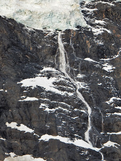
Ice avalanche down Glaciar Frances

Upper French Valley and Rio Frances
With our (not so) early start we
were the first people up there and had 20 minutes to ourselves before
the first other people started to arrive. Then in the hour it took
us to get back to our camp we passed around 150 people and those were
the early risers. It would get even busier later in the day. In fact we
thought that the “W” should be renamed the “O-la” since
everyone says Hola (Hello) to each other as they pass.

Sunrise view along the W

Views from part of the W

Foxes were often seen at campsites
The other out-and-back was
up the Rio Ascencio valley to Mirador Torres. It is popular to get
to this lookout while it is still dark in the morning and then watch
the sun rise on the famous Torres del Paine – the namesakes of the
park. These are three monolithic towers of rock and the morning sun
shines directly on to them. There was a long line of headlamps
heading up to the viewpoint that morning. We took a Nalgene full of
coffee and our sleeping bags so we were very comfortable as we laid
on large rocks and watched the show. There were no clouds and just a
small amount of wind so it was a great morning. It would have made a
great time lapse movie.

Sunrise on the Torres del Paine
This valley was even more crowded then the
French valley and by the end of it we were hating people and ready to
head to the backside of the park. The final straw was watching an
American trail runner elbowing people out of the way on the trail
because for whatever reason he couldn't stop running for a minute to
get around people politely. It has been one of the few instances on
World Tour where we have seen embarrassing American behavior. Plus
he was giving trail runners a bad name so it was a double whammy.
The “O” was the part we had really been waiting for. The trail is limited to 80 people a day and
everyone has to go counter-clockwise so we would be seeing far fewer
people on the trail. In fact when we went through the checkpoint
where we had to show our backside permit only 39 people went through
that day. The hiking is more scenic though the mountains are not as
dramatic as they had been on the “W”.

Hiking into the backside

Lago Paine looking toward Argentina
Our first night on the “O”
there was a very hard frost that night so most everyone was cold that
night. By this time we had met a group of friends that we would hang
out with every night. It was quite the international group – 2
Americans, a dual Irish-American, a dual Iranian-Canadian, an Aussie,
a Scot, and 2 Brits. One of the British girls (Abi) had been on the boat to Antarctica with us.

Left to right: American, Scot, Brit, American/Irish, American, Iranian/Canadian, Aussie, Brit.
We were all excited about the campsite at
Refugio Dickson. It had been built up as the best campsite of the
trip but we found it to be very mosquito infested and the guy walking
around in a Tyvek suit with a respirator spraying the buildings with
pesticide did not inspire confidence. It was prettier down near the
lake and the wind there kept the bugs away.

Lago Dickson and campsite
John drank a fair amount
of wine that night so did not feel that chipper the next day. John
Gardner Pass was the next obstacle in front of us. The wind forecast
was worse for the next day so we elected to do a double hike past the
Los Perros camp to get to a free campsite on the other side of the
pass called Capamento Paso. John was feeling low energy but wanted
to get to the free campsite. It rained off and on all day and was
even snowing on the top of the pass. It was a damp, cold day and not
that much fun. The woods, mountains, grey, and rain actually reminded us
a lot of being back in Washington. From the Los Perros camp it was
about a 3 hour hike to the top of the pass. About an hour into this
was when John's mountain luck ran out. We have been pushing our luck
in the mountains for the last several years so it seemed like a
matter of time before someone got hurt. It would be nice if there was more adventure and
excitement in the story but there isn't. We were traveling through
an area that had deep areas of mud. So deep that our trekking poles
would not reach the bottom of it. John was trying to cross one of
these areas using tree roots to keep from sinking into it when he slipped
on the wet muddy wood. In the process of stumbling forward several
steps his left ankle rolled and he felt a pop. From then on every
time the ankle had any lateral motion there would be a painful pop as
the peroneal tendon would flip over the bony protuberance of his
ankle (fibular malleolus). There is no search and rescue in the park
and horses are not able to get to this part of the trail. Luckily as
long as the foot was placed flat and the motion was only
forward/backwards then he was able to walk. The closest way out of
the park was to continue over the pass so we did. We were slower as
John had to be very careful, especially when the terrain was uneven.

Paso John Gardner about an hour after injury
On the top of John Gardner Pass the wind was so strong that it was
almost impossible to take steps forward without getting knocked down.
We would have to wait for brief periods of the wind speed dropping
to move forward a few steps. The scenery on the west side of the
pass is the best of the entire park. From the pass until Refugio
Grey is reached is stunning as you look down on the Glaciar Grey and
Southern tip of the Patagonian Icecap. We have only seen ice like
that in Alaska and Antarctica before. Row after row of crevasses for
as far as the eye could see.

Pictures couldn't capture the scale

Lago and Glaciar Grey
The last two days to hike out were
about 10km each day with much smoother trail so John was able to
continue hiking out though once we reached Refugio Grey we were back
on the “W” highway.
The end of the trail took us to
Lago Pehoe where we were able to catch a boat across the lake to
where the busses would pick us up and take us back to town. Despite
getting hurt we were glad to have been able to do this trail. We
have discussed coming back some day and running the “O” loop over
2 days. Now John has his ankle immobilized in a splint and we will
see if this lets it heal or not. In the meantime we are going to go
to Santiago to recuperate. Depending on how the ankle is we will
either continue on to northern Chile or worst case have to come home
for further treatment.
 Ferry from Anacortes to Friday Harbor
 Bald eagle that was fighting a vulture over a dead fish.
 Posey Island camp with Spieden Island and Channel in background.
  Looking out on Haro Strait from Posey Island
 Posey Island Camp
  Olympic Mountains visible down Mosquito Pass
 I had never seen Haro Strait this calm
  Lunch break at San Juan County Park
  Lots of seals. :-) No whales. :-(
  Lime Kiln Lighthouse - one of the (not scary) scary spots on the paddle
 Turn Island campsite
  There are some incredible boats in these waters
  Deer on Turn Island


