Monday, December 15, 2014

Namibia - right from the pages of National Geographic


     I think that the first exposure most Americans have had of Namibia is from the pages of National Geographic. I know it was mine. I remember reading about the drought tolerant lions and elephants, seeing pictures of wrecked ships being pounded by the surf, and the incredible orange dunes of the Namib Dune Sea around Sossosvlei. I would look at the pictures and read the stories thinking “That would be neat to go there", but the chance never materialized. It is a long way from the United States. Then we heard from our Canadian friends Kristin and Ryne that they would be in southern Africa at the same time we would be. Schedules matched up that the Namibia section of their trip would be the time to meet them. Without them we probably would not have made the side trip there. Thanks KOP and Ryne!!!!

      Home base Africa is in Pretoria, South Africa where Kathleen's grad school friend Dawn, husband Paul, and daughter Piper live. We were able to spend Thanksgiving with them. We were able to have a delicious potluck feast with members of the USAID, CDC, and State Department community which even included an informal 5km Turkey Trot. It was nice having a little dose of Americana after being on the road for so long. There are several discount airlines in South Africa so we were able to get a cheap flight to Windhoek, the capital of Namibia. This was where we first really felt like we had burst out of our protective bubble with Dawn and had truly entered Africa. Almost immediately we noticed that the cost of things, especially food in the grocery stores was not that cheap (close to US prices) for a nation where the per capita income is $5461 per year. Like in South Africa (and the US), the income distribution is among the most unequal in the world so there are many people that make much less then this. How people afford food was one of the big questions we had.

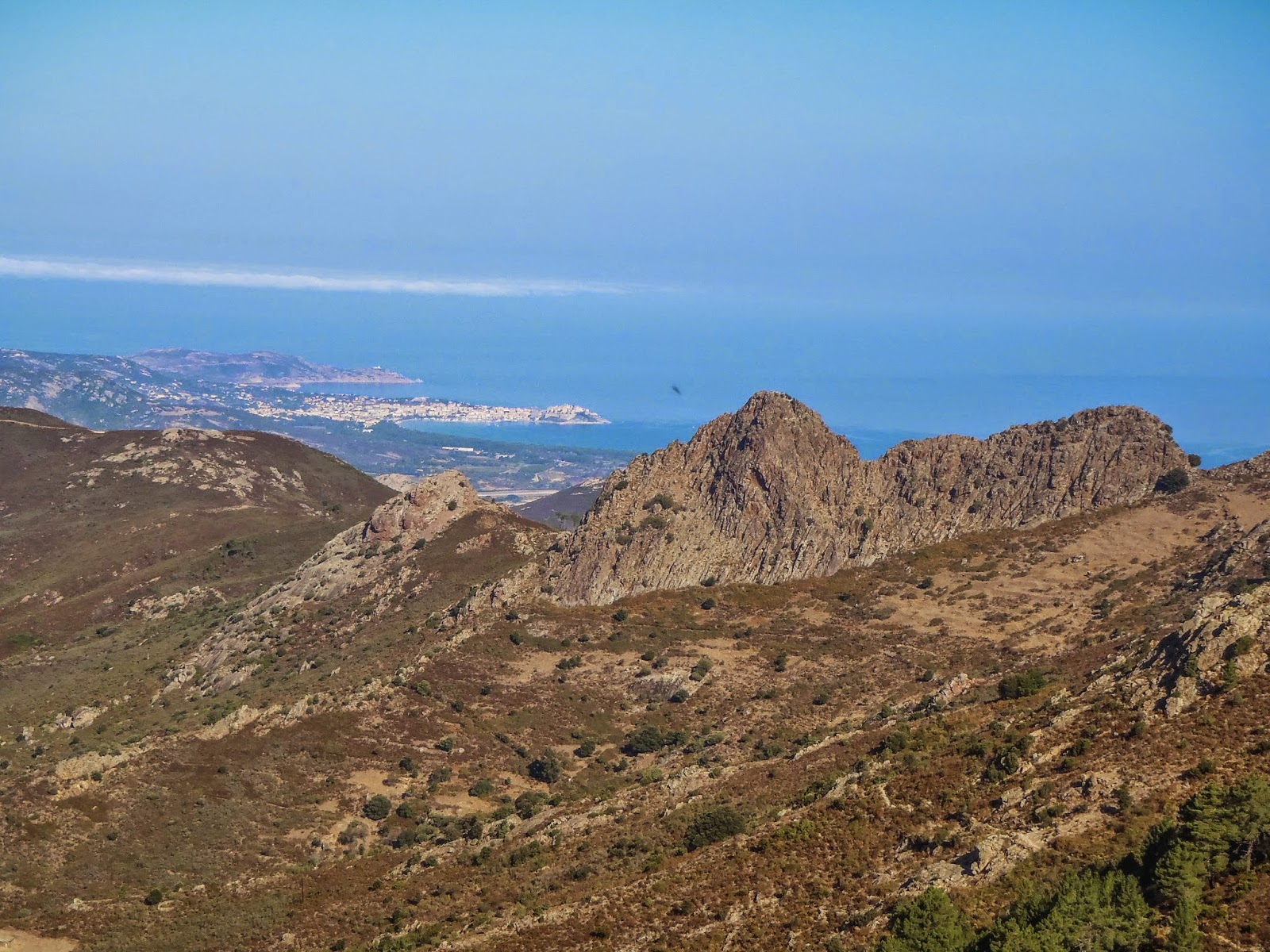
      We all rented a car and drove about 6 hours to Sossusvlei in the Namib Dune Sea. Namibia has one of the lowest population densities of any nation in the world. Miles and miles of savanna with rocky mountains jutting up out of the plains were stunning. 
Big sky country

Once there, huge bright orange dunes stretched for as far as the eye could see with bright white salt pans reflecting the sun in between them. We often felt like we were on Mars traveling through this landscape. We spent 2 days climbing 1000 foot steep sand piles, exploring a slot canyon, and eating too much food at the extensive buffet. 
View from Dune 45
Summit of Dune 45
Deadvlei (Dead marsh)
Climbing Big Daddy Dune
View of Deadvlei from Big Daddy
Deadvlei playa
Slot canyoneering in Sesreim Canyon

We had a great time hanging out with Ryne and Kristin but it was unfortunately too short as they had to move on to Cape Town while Kathleen and I spent another week and a half exploring Namibia. 

      For the next section of road trip we rented a 4x4 truck that we kept describing as “Snorkel in the front, Fridge in the back”. The front had a sand snorkel due to the dusty conditions. The bed of the truck had a canopy that was a solid metal box that could be locked very securely. There was a fridge in it that ran off a separate battery and worked very well. The back had drawers to hold supplies and a folding table. There was a large water tank and two spare tires. We want a truck like this for home.
"Snorkel in the front, fridge in the back"

Our next destination was The Skeleton Coast. Even though we were warned that the coast would be “overrun” due to the holidays we found only isolated beaches with huge cold pounding surf and large flat beaches that reminded us of the Washington coast. 
Fog back drifting up coast        
Sunset over the Atlantic Ocean

For centuries ships have been crashing into this shore so we would occasionally pass the remnants of hulls sticking up out of the surf or half buried in the sand. 
Wreck of "South West Sea"
Rusting oil derrick in desert

We also stopped at the Cape Cross Seal Reserve where it is reported that up to 100,000 fur seals live. I am not sure if it was that many but tens of thousands of seals stretched for a couple of miles along the shore and in the water. Every sound known to animals could be heard from the seals – sheep baaing, goats bleating, cows mooing, horses neighing, dogs barking, squeaks, moans, groans, and screams could be heard. A boardwalk allowed us to walk right amongst them. The seals are constantly trampling over each other and fighting as a result. It was not a place for the faint of heart. Some of the visitors we saw at the same time left in tears. The smell could bring you to tears also. While we watched we saw one baby seal get trampled and killed and dead baby seals littered the sand. At the same time we witnessed two baby seals be born. We had only ever seen something like that on TV before. It was so fascinating to watch that I didn't want to leave. 
Cape Cross Seal Reserve          
Seal pup being born                  
Bad place to be a fish               
Adding her voice to the bedlam


     Once we left the coast we entered Damaraland where there is ancient rock art from 3000-6000 years ago.
 Twyfelfontein World Heritage Site

This is in an area where they speak one of the click languages. You know you are not in Kansas anymore when you are in a bar and everyone is speaking click around you with the ticks, tsks, and tocks. It is really fun to listen to and makes me smile every time I hear it.

      Our last stop was Etosha National Park where you are allowed to do a self drive safari. We spent two days driving the park along the edge of a salt pan that is big enough to be seen from outer space. We saw all sorts of animals – impala, springbok, reedbok, foot long centipedes, zebra, giraffes, wildebeest, numerous lions, cheetahs, and 2 white rhinos. 
Giraffe      
Wildebeest
Ostrich      
Giant millipede
 Lion                
Zebra               
Lazy Lions      
Etosha salt pan

We even got to see lions protecting their zebra kill from the jackals and 3 cheetahs fail to try to take down a springbok. The only disappointment was we were never able to find elephants though this time of year they have migrated to the mountains. On the second day we had a flat tire while driving in the park. It was the first time I have changed a tire while needing a lookout due to the risk from being attacked by a lion. I had that tire changed in 5 minutes. Nothing like some motivation to work fast.

      If you want to drive around with your mouth hanging open due to the scenery and beauty around you then visit Namibia. Most of the roads are dirt but are in excellent shape compared to what I had seen before in other parts of Africa. You have to stay vigilant since it is Africa after all but we felt safe where we camped. We did find jackal tracks right outside our tent one morning. We both felt that 2 weeks was not long enough. Some day we would like to go back to explore Fish River Canyon and to see the ghost town of Kolmanskop. Namibia was a great introduction to Africa and ranks up there with Laos as one of my favorite countries visited so far on this trip.

Monday, November 24, 2014

FidEgan's FastPacks - Episode 8 - The Lycian Way - Turkish Hiking, History, and Hospitality


John and I are currently on a world trip where we plan to persue our passion of trail running through the various landscapes and environments of the world. As we pass through each country we want to post our top pick for a trail run that we did. This does not mean that this is the best trail to run in that country. It just means that it was our favorite that we did. We are both using Ultraspire Fastpacks to carry our gear, hence the name of the column.

In this case this we did this trail as a backpack. It theoretically could be done as a Fastpack but because we are currently living out of our backpacks, and it's a point to point trail, we elected to carry all of our gear and full camping equipment and take our time as we moved along the coast. It was just easier that way.
One of many incredible sunsets

Where: A hiking trail that follows the southern coast of Turkey between the cities of Fethiye and Antalya. Most people hike this trail in the spring, but fall is another popular time. Summer is too hot and during the winter the upper terrain is covered in snow.

Facilities/Trailhead: The trail ends are in the villages of Ovacik in the west and Geyikbayiri in the east which are close to the towns of Fethiye and Antalya, respectively. There are many towns and villages along the route that have bus and dolmus (minibus) service so shorter sections of the trail can be easily hiked. For the entire length of the trail with the exception of two sections in the eastern mountains there are pensions and hotels you can stay at. Sometimes this means catching a dolmus at the end of the day to get into town but you could do the majority of this trail without camping gear. However, if you have a tent and cooking gear then the variety of camping spots is vast. Water is the only limitation when it comes to camping as this region is very dry. Many of the cisterns and water sources along the trail are less than ideal. If you camp then you absolutely will want a water filter (not just water purification tablets). Camping fuel is also a difficult find. White gas or butane canisters might be able to be found in Fethiye or Antalya, but not easily. A Whisperlite International that burns gasoline would be a good choice. 
Kabak Beach pension    
Camping amongst ruins

Fees: There is no cost involved with hiking the trail itself except for at Chimaera and Guynuk in the eastern end of the trail.  There the trail passes through "park" areas that charge a few dollars for entry.  If you are going east to west there would be a charge to enter Olympos but going the other way you enter the area from the mountains were there is no entry gate.  Staying in pensions ran in the 70 to 120 Turkish Lira range per night (~$30-$55) for two people. Eating in restaurants usually cost about 15-20 Lira ($7-9) for an entree. The food in Turkey is amazing, one of many things we will miss about this country. Word of warning about this trail – the availability of ATMs along it is sparse. Have plenty of cash on hand so that you don't run out in the middle of the trail (like we did) which involves a day of riding buses for hours to get to a money source.

Terrain/Trails: The trails runs the gamut of terrain types. From goat paths, to single track trails, sandy beaches, Lycian and Roman roads that are worn smooth by 3000 years of feet and hooves on them, to dirt and paved roads. Much of the smaller trails are covered with fist size rocks that would probably make running on the terrain (for many) painful. The trails are marked by yellow signs and red/white paint hashmarks. For the most part the trail is well marked and if you go more then 200 meters without seeing a marker then you need to start looking around. Many days we would miss a marker or turn but would quickly realize it. There is some trail rerouting going on Gurses and Demre which is the only area where we really got lost. Part of our problem was that we had an old edition of the guidebook and map. Having the current edition with the latest updates probably would have solved that problem.
Sign trail markers 
Paint trail markers

Distance: The trail runs for over 500km (300+ miles) along the coast and coastal mountains of southern Turkey. The guide books describe hiking the trail over a 30 day period. We took 38 days as we would find a scenic beach or town and not want to leave. It was refreshing not to have to make a deadline as there are some incredible spots along the coast that warrant a longer stay.

Description: This trail has a huge amount of the three things we like best about Turkey – hiking, the history, and the hospitality. The hiking is gorgeous. Sometimes you are at sea level walking along the beach. At other times you are at 5000+ feet with panoramic views. Every corner we went around there was a new sight or perspective to see. The history along the trail is like nowhere else we have ever seen. Layer after layer of history going back 3000 years just lying in the bushes everywhere as we walked along, from the early Lycians who fought against Greece in the Trojan War, to Persia, Alexander the Great, Romans, Byzantine, the Crusades, the Ottoman Empire, and now theTurkish Republic. There are all types of ruins and buildings all along the trail: Lycian tombs, remnants of cities, Roman amphitheaters, baths, and aqueducts, some of the first ever Christian churches, forts built by Christian Crusaders, Ottoman era cisterns, and statues of Ataturk line the path that we hiked. It was a rare day that went by without passing some piece of history. 
Trail is a Roman aqueduct
Roman aqueduct Delikkeer
Statues of Ataturk abound  
After several earthquakes some of the ruins are now under the ocean where you can swim or kayak over them. Turkish hospitality like most Muslim hospitality we have met cannot be beat. Strangers would invite us to stop and have tea, bread, and olives with them. People would pick apples, pomegranates, and grapes and give them to us as we hiked by their homes. The Turks would also be very helpful as we moved along the trail. Many times as we left one village we were told that their friends in the adjacent village would be ready to receive us once we got there; “it is only a phone call away”, they'd say. The one warning we would offer for those considering this trail is to beware if you are allergic to bees or have a fear of snakes, or dogs. This region is known for its honey making, especially in the western part of the trail closer to Fethiye. There were thousands of bee hives that we passed so often you could hear the trees buzzing with them, and some of the water sources are overwhelmed by them. The bees seemed fairly docile, however, so as long as you don't freak out they will not bother you. John did get stung once in the ankle when one got caught between his foot and shoe but that was a freak occurrence. 
Cluster of bee hives
We saw multiple snakes. None of the ones we saw were poisonous, though they do exist here. Most were grass snakes which are harmless as was the Whip Snake we saw. However, the Whip Snake was very large (~6 feet) and moved super fast (faster then we could run) which was a little unnerving. Probably the biggest threat was all the dogs, especially the sheep dogs guarding their flocks. Many were just noisy and were scared to come close but there were a few that were downright aggressive and had to be chased off with our hiking poles. We were warned by several Turks that these dogs can be dangerous, especially at night. 
View over Olu Deniz
Canyon to Alinka
Leto Temple, Letoon
Letoon Amphitheater
Harpy Tomb, Xanthos
Amphitheater, Xanthos
Tombs with Arch of Modestus
Genoese fort, Simena              
Ucagiz Bay                             
Medusa, Myra                        
Tombs in Myra                      

If you enjoy eating excellent food, good hospitality and hiking all day through ancient history then this trail might be for you. There is a reason it was voted on the World's Ten Best Walks.


Monday, September 29, 2014

FidEgan's FastPacks (or not so fast) - Episode 7 - The GR 20, Corsica, France

John and I are currently on a world trip where we plan to persue our passion of trail running through the various landscapes and environments of the world. As we pass through each country we want to post our top pick for a trail run that we did. This does not mean that this is the best trail to run in that country. It just means that it was our favorite that we did. We are both using Ultraspire Fastpacks to carry our gear, hence the name of the column. On this trip we had our Fastpacks for the side trip we did but for the main trail full size backpacks were needed for all our camping gear.

Where: The GR 20 hiking trail which traverses the island of Corsica from north (Calenzana) to south (Conca).
Map from Wikipedia
 
Facilities/Trailhead: The trail is split into a northern and southern section with the village of Vizzavona being considered the middle point. In the north the town of Calvi can be reached by train or bus. A bus or taxi will be needed for the last ~10km to get to the trailhead in Calenzana. The southern terminus in Conca can be reached from the town of Porto Vechchio by bus. Vizzavona has a train station which is the best way to get there. There are some supplies available in each of these towns but it will be cheaper (and better selection) if you stock up on any supplies you need in the larger towns. Have enough money with you. They take cash only and the nearest ATM is an hour train ride from Vizzavona in the town of Corte.

There are Refuge mountain huts where you can stay or camp. Camping is only legally allowed at the Refuges. It takes between 5 and 9 hours of hiking between the huts. During the summer months there is food served (breakfast/dinner). There are also some private Bergeries scattered around but we didn't count on them. They were bonus places to find a tasty lunch (homemade cheeses, fresh bread, salami and drinks). The huts are often full and crowded. We elected to bring a tent and stove so we could could feel independent. This caused heavier backpacks and a slower pace but decreased the worry of not having a place to stay. It is possible to make reservations beforehand, however. The Refuges also had tents that they rented. Most Refuges had a kitchen or outside gas stove that the campers could use and each had some limited supplies for sale (pasta, tuna, chocolate, biscuits, bread, soup, wine, beer, beans, etc).
Refuge Tighiettu - Stage 5
 
Fees: The huts were typically 13 Euros per person to stay in. Camping was 7 Euros per person; renting a tent was an additional 10 Euros per person. We found the meals a bit pricy for what you received. 20 Euros for dinner (soup, pasta, dessert) and 10 Euros for breakfast (typical European bread, butter, jam, tea/coffee). Two people completely relying on the huts would be spending around 83 Euros per day not including any alcohol, drinks, or snacks. It adds up so bring a big wad of cash if you are going this way. We cooked our own food and slept in our tent and spent around 40 Euros per day for everything (less alcohol would have made it a lot cheaper).
Terrain/Trails: The northern section (9 stages) is the much tougher section of the hike and involves a fair amount of scrambling. There are many spots that are steep with large exposure. Chains and handrails exist in some places but in many areas you will be using your hands to climb across the rocks. If you don't like heights then this part of the trail is not for you. The rock tends to be solid granite and makes for beautiful climbing. If you rock climb this would be a great place to have a rope and full climbing rack. Climbing lines of all levels are in every direction you look.

The southern section (6 stages) is less rocky and rugged but passes through some very pretty areas. The Plateau de Coscione is the well known part of this but there are many other scenic spots.

Most people hike the trail from north to south to get the technical parts done while they are still fresh. This is the way we went. Hiking from south to north would be better for photography as the sun will be at your back as you walk.

This is the best marked trail we have ever hiked. There are red/white paint marking and cairns. If we went more then 100 meters without seeing a marker we would instantly stop and look around since we were off course. We did not have a guide book, only a map and probably could have done it without even that (this is not recommended however!).
Trail marker
 

There are a number of side trips possible along the way. There are mountains to climb or lakes to hike to. There are also a few places where there are “variants” - usually the variant goes over a mountain while the “normal” trail goes around.
Distance: 180 km or 112 miles with about 33,000 feet of vertical change. This is considered to be one of the most difficult (and scenic) hiking trails in Europe and is listed on the National Geographic Adventure website as one of the 20 all time epic trails in the world.
Description: We chose to do the trail slowly and just hike hut to hut. There are some days where it is totally possible to do a “double” and shorten the time spent out there. The standard is 15 days. The French Foreign Legion do it as a military training exercise in 7 days. The record is an INSANE 32 hours by Guillaume Peretti.

The first day is mostly up and takes you into the rocky steep first half of the trail. If you start in the morning you will spend most of the day in the shade which is good because it can get hot in Corsica, especially lower down. Section 2, 3, and especially 4 are the most technical of the route. On section 2 with our heavy packs it took us 6 1/2 hours to go 7km. The trail consists of a lot of up and down steep scrambling with little forward progress. Day 4 is the Cirque du Solitude which is the crux of the whole trail. Here is where you find the most chains, metal ladders, and hand rails to help get through this area. Even with the artificial help you will still have a lot of exposed rock scrambling to do. Being comfortable with exposure helps in getting through this section. It would be a very bad place to fall. Section 7 has some beautiful lakes that can be climbed down to. From there to the halfway point at Vizzavona there are still some brief scrambling areas but much less. 
 
 
The southern section of the trail is more mellow. The trail goes through more forested sections but there are also large meadows, ridgelines, and fields you pass through. The Plateau du Coscione provides huge wide open vista views and easily competes with the north for beauty.
 

In both sections we saw Mouflon (wild sheep), wild boar, and foxes. Be careful about leaving food lying around. 

Mouflon sheep                


We took the side trip to the top of Monte Cinto which is the highest point in Corsica. The trailhead for this is at the end of Stage 3 (Refuge Ascu-Stagnu). There is some rock scrambling involved here and makes a great day trip. 
Summit of Monte Cinto