Tuesday, May 28, 2013

Baja - The Roadtrip

     At the end of the paddle I hung out at the La Concha Hotel in La Paz for a few days with my Mom.  I didn't do much while there.  Went into town once and ran a couple of times but mostly sat around at the bar and worked on downloading pictures, writing blogs, and eating real food.  My Mom then graciously watched over my gear and kayak while I flew from La Paz to Las Angeles via Mexico City to be reunited with Kathleen who was also flying to LA on the same day.  Despite having only a one way ticket, just a carry on, and having been in Mexico for 2 months I was barely inspected coming into the country.  I arrived at Home Base LA (my friends Juli and Morgan's house) late that night.  It had been way too long since I had seen Kathleen and now we could consider that World Tour was truly taking off since this had always been her plan and dream in the first place.  My truck, some gear, and a duffle bag of clean clothes had been left at Home Base LA.  The next day was for running errands and we had initially thought about leaving the next day but we delayed a day just so we could relax together and hang out with Juli and Morgan.  They have a beautiful house with a pool and are the best hosts ever.  We hope someday to have a living situation where we might be able to repay a fraction of their generosity.
     On 5 May we loaded up the truck and headed for the border.  We crossed at Tecate and it may have been the easiest border crossing I have ever had.  We drove up to a gate, the light turned green, the gate went up, and we were in Mexico.  There were 2 soldiers off to the side talking to each other but basically no one even looked at us or checked anything coming across.  It was more like driving into a parking garage then an international border.  We managed to drive to a town called Santa Thomas that first day to a campground that had a restaurant across the street.  That was the most expensive accommodation of the road trip - 200 pesos which is $16.67.  For some reason every time I enter Baja it rains the first day.  It was raining the morning I started the paddle and it rained that night on us in Santa Thomas.  From then on it was solid blue skys, white fluffy clouds, and very warm. We then cranked out miles for the next two days to get to La Paz as quickly as possible.  There is a 2 lane paved highway that goes all the way there that is in pretty good condition though it is narrow with no shoulder.  If you drop a wheel off the side of the road you would be in trouble pretty quickly.  The drive was very scenic with sweeping vistas of mesas, valleys, arroyos, both the Pacific and Sea of Cortez, and a variety of cactus and elephant trees. 
First camp of World Tour - Santa Thomas

  
     We reunited with my Mom in La Paz who had been having her own little adventure meeting people.  We spent 2 nights there recovering from the road burn before it was time to send my Mom off at the airport and to head off on our own to explore the peninsula.   We also started to run together to prepare for this summer of major ultra running.  I had been sitting in a kayak for 2 months so I was not in running shape but I was heat acclimated.  Kathleen had been running some but she was not used to the heat.  This evened us out pretty nicely so we remain good training partners for each other.  Initially we headed down to Todos Santos and then Cabo San Lucas.  We didn't really want to see the tourist sprawl of Cabo but since we were that far south we figured we should touch the southern end of Baja.  Todos Santos was a nice little town that has an artsy Carmel feel to it and Cabo wasn't quite as bad as I expected.  I had expected it to be like Cancun which it was but not as big.
Mom and me

Hanging out at the LaConcha Resort

     Driving back north was when the one hiccup of the entire trip occurred.  We were driving back north through the outskirts of La Paz when I was pulled over by the Municipal Policia.  I was speeding by 15 or more miles per hour but really was just going with the flow of traffic.  I was singled out because we were gringos with American plates and two giant kayaks on the roof.  The cop took my drivers license and registration and then told me that he was going to hold on to them for security because I had to go downtown to the police station to pay the fine which was 12000 pesos or $100.  My Spanish which is not good in the first place became much worse on purpose when he pulled me over. I explained (in English) that if I went to the police station it would mean that I would have to drive at night to get where I was going and that was very bad.  I also told him that I would have to put the fine on a credit card since I didn't have that much cash (that was a lie).  He then asked "How much cash?".  I told him I would go check, went up to the cab of my truck (we were talking next to his cruiser), quickly took most of the money out of my wallet and stashed it under some stuff, and then walked up to him and showed him that I only had 500 pesos ($40) in my wallet.  He decided that was enough, gave me my documents back, and on our way we went.  I obeyed the speed limit much more strictly when we were in towns after that.  It also made me wish that there was a way to bribe the red light cameras in Seattle.  A $40 bribe is way better then a $140 red light show up in the mail ticket.  I think this experience has made me a little more pro-corruption.
     Driving north we spent some time in Puerto San Carlos on Magdalena Bay which is where the grey whales come to have their babies.  By the time we got there they had already left except for one juvenile who everyone thought was sick and likely dying.  It ended up being too windy while we were there so we never did put the kayaks in the water.
Magdalena Bay at low tide - San Carlos

    We then went and spent a few days in Mulege.  It had been one of my favorite spots on the paddle and Kathleen also fell in love with it.  We camped on the beach next to the El Patron restaurant/bar and did some running.  We also had lunch at Bahia Coyote which is a gorgeous beach on Bahia Concepcion. We met all sorts of cool characters while hanging out here.  Many of the ex-pats we met (both American and Canadian) think that the bad publicity Mexico is currently getting is a conspiracy plot by the corporate media to keep American retirement and tourist dollars within the U.S. 
Mulege Estuary

     Just outside Mulege was Punta Chivato.  We drove up there and looked up Russ again who had been very hospitable to me when I paddled through.  I am voting Russ's house as "Best place in Baja to show up unannounced".  Our timing was great because he was due to drive up to San Diego the next day.  He was hanging out with his friend Carol who ended up being Kathleen's "soul sister".  Lots of things in common from growing up overseas to similar careers.  We drank several bottles of wine before driving to a nearby beach and spending the night.  Another huge thanks to Russ for showing us a good time and for all the food he gave us to eat for the next few nights.  
    We then drove into the desert and camped out in the Valle de los Cirios to do some trail running.  Actually for parts of it there was no trail but the desert provides a great environment to just run cross country until we hooked up with some ATV/4WD roads.  The elephant trees were like something out of a Dr Suess book and made a neat landscape to run through.  Our runs gradually were becoming longer and harder as we started to feel a little more in shape. 
Valle de los Cirios

     From there we cut back to the Sea of Cortez on a "primary rural route" which means that it was a pretty rough dirt road where the fastest you could really go without beating up your vehicle (and the kayaks on the roof rack) was about 15mph.  We drove to Gonzaga Bay for an incredibly windy night and then from there got back on paved roads to San Felipe (where the paddle had begun) and then back to the United States.  Crossing the border wasn't that difficult.  We got into the wrong line which turned out to be one of the fast lanes.  Even though we didn't have the correct preauthorized card to be in that line they did not yell at us.  They tried to trick me with the question "What do you do for a living?" and then let us through.  We probably got through the line 45 minutes to an hour faster then we would have if we had been in the "correct" line.
Kofa NWR, AZ

Mt Wilson, Sedona, AZ
Some camp spots were just weird


     We then spent a few days crossing Arizona.  Beautiful desert runs in Kofa National Wildlife Refuge and then Sedona which Kathleen absolutely fell in love with.  We ran up Mt Wilson which was our hardest run yet.  Kathleen ran past a rattlesnake.  I was following her so by the time I got to the snake it was pissed off, coiled, and ready to strike.  Luckily I heard its rattle over my I-Pod and stopped in time.  Despite being in deserts lots of times this was the first rattlesnake I had ever seen.  We then also spent a day exploring Petrified Forest National Park before driving to Durango. 
      We spent a week in Durango.  My Mom and brother live there.  Both Kathleen's parents and my Dad flew out to see us off.  It was a time to visit family and friends, sort through gear and pack, explore some of the territory around Durango, get some runs in, and my nephew Elias was in a baseball tournament that his team won.  It was a good week but very busy.
Elias at bat

     The last week of World Tour Prologue was in Boulder.  We flew there from Durango.  One of the rougher flights I have had.  There was wind shear going on in Denver so we had to make multiple attempts to land while the plane bucked around.  Multiple people got sick including the guy sitting next to us.  Kathleen even fanned him with the Emergency Instructions card to try to help him feel better.  The week in Boulder was another crazy week trying to cram in as many friends as we could.  We watched the elites run the Boulder Boulder.  It is amazing how fast they go.  We were on bikes and shortcutting the course and even then could barely keep up with them.  More runs, happy hours, Farmers Market, and ending up the week with a Postal Service concert at Red Rocks rounded out the week. A big thanks to Krissy for letting us crash at her house.
Cheering on the Boulder Boulder
Boulder Boulder Mens Elite Start

     Next stop is Iceland for 7 days before going to Ireland to see family and explore the Emerald Isle.    

Wednesday, May 8, 2013

Baja Sur - Part 3 of 3 - The summary of kayaking the Sea of Cortez

     From Mulege I paddled into Bahia Concepcion  This added extra miles to the trip but I wanted to see it.  It is a scenic sheltered bay with multiple small islands.  A good place to take novice kayakers but beautiful enough to entice experienced ones.  At Playa Santispac where I camped I was not roughing it.  There were 2 restaurant/bars and an ice cream truck would periodically drive by.  I met a bunch of great people there (Tom and Dan of S/V Persistence, Pete, Janeene, Allen, Cathy, Louie, and Cindy) along with seeing many of the same characters that had been in the bars in Mulege (like the ever present Bob).  It was a fun place to hang out for 2 days with a fishing tournament going on the first day with a big fish fry and "Disco Night" the second.

View from Playa Santispac

Leaving Santispac              

     Once I left Santispac it was time to get serious again.  The section going around the Concepcion Peninsula that forms the bay is the second most remote section of coastline. 
Punta Hornitos - Concepcion Peninsula
     The second day going down the Peninsula turned out to be the scariest day of the trip.  The North winds had started the day before and had built up a good sized swell.  In the morning I thought that it had died down some but I was wrong.  The morning started off with a pod of dolphins not noticing me because of the choppy conditions.  They were leaping out of the water and didn't see me until one landed about 3 feet from the right side of my boat and I started screaming at them.  When that dolphin first launched out of the water I really thought that 200 pounds of dolphin was about to hit me.  That was just the start of the day.  The swells kept building from my left rear side.  In a kayak your butt is basically at water level so your eyes are about 3 feet above the water.  These waves were way over my head so they had to be at least 6 or 7 feet tall.  They would not only block my view of the horizon but they would block out any view of the mountains also.  I had never paddled in water this big.  I would surf down the waves which would cause me to hit wind waves that were blowing sideways from my right causing spray to fly all over me.  At least it was warm water.  The swells were hitting the beach making big surf.  The shore looked even scarier then where I was so I was stuck out there until after several hours I finally got around Punta Santa Theresa which protected me from the swells and I only had to deal with the wind waves. 
Concepcion Peninsula
The first good place to camp that day was a cove called San Sebastian.  This turned out to be a private community but luckily the guy I asked about camping was the land owners son.  Scott and his wife Joy took one look at me, said "we can't send you back out there" and then fed me not only lunch but dinner as well along with showing me a place to camp. 
Camp 33 - San Sebastian
     The next day was still rough but nowhere near as bad and for the rest of the trip I was able to say "at least it's not as bad as that day".  This day I passed a towering rock/mountain with cliffs hundreds of feet high that jutted out into the sea called Punta el Pulpito.  It ended up being the most impressive point of land on the whole coast. 
Punta el Pulpito
Like the entire geologically tortured coast this mountain was made of a variety of different rocks and even had sea caves/arches that I was able to paddle through.  Anchored at the base of this point I met a Canadian couple on S/V Prairie Oyster.  We had a small world experience where they knew of my friends Shawn and Ben's boat, S/V Pangea from when they were in the South Pacific in 2008.  I hiked to the top of the point and it had some great views but was crazy windy. 
View of S/V Prairie Oyster

View north from el Pulpito
    On the beach and in the water where I camped at the foot of the mountain it was covered with gelatinous fish eggs that were about 0.5cm in diameter.  I have no idea what kind they were. 
Fish eggs on beach
     The day before reaching Loreto I went extra miles to get close to town.  The current was also really working against me so I was pretty tired at the end of the day.  However, when I got to where I had planned to camp all the spots sucked and I kept being swarmed by bees.  I tried four different places before deciding to paddle across the 2 mile channel to Isla Coronados.  There was a small island halfway across where I could catch my breath and be sheltered from the current.  I ended up camping on a gorgeous white sand beach but it turned out that the other group camped there was part of a rattlesnake relocation program.  They were trying to catch the snakes that had been hanging around the campground and move them to another part of the island.  If it's not one thing, it's another. 
Camp 36 - Isla Coronados
     Despite being tired from paddling 22 miles against current that day I still had energy so I went for a 1/4 mile swim/snorkel and then ran the 5 mile out and back to the top of the island which had sweeping views of both what I had paddled and the upcoming section. A Baja triathlon. 
View from top of Isla Coronados
     I stopped in Loreto and spent an extra day there.  This was the location of the first successful settlement and Jesuit Mission by the Spanish and is as old a town as you can find in North America.  It was the last place for supplies before the 175 mile run to La Paz.  I had noticeably lost weight by the time I got there.  The first night I had 3 chicken enchiladas with rice and beans at one restaurant and then went and ate an entire family size pizza at another. 
     As I was packing up the boat to leave Loreto a damn Lab came up and started sniffing my gear.  I didn't think anything of it until he lifted his leg and claimed it as his own by pissing on it. At least everything was in dry bags so I could rinse it off.  That day got me to Puerto Escondido which is a great hurricane hole for boats and has a big marina.  It was there that I saw news of the Boston Marathon bombing.  This terrorist attack effected me more then many others since it was directed at my running brethren and I have no problem imagining me or Kathleen being there during the race.  The yacht club there had a big book exchange so I was able to get some new reading material.  The reason books are free in a book exchange is because they all suck.  Way to many murder mystery and romance novels.  I did manage to find a couple of books that worked though - a spy novel and a Revolutionary War historical fiction book. 
Baja Outdoor Activities guided group
     It was the next day of the trip (Day 40) that I saw my first kayakers go by.  I was fishing at the time so didn't have my camera to catch the moment I had been waiting weeks for.  I got up early the next morning to catch up with them and took their picture.  It was a group of 8 clients (including a 77 year old woman)  with one guide from BOA (Baja Outdoor Activities) doing a shorter version of the Loreto to La Paz paddle.  We chatted and the guide warned me that a north wind was supposed to blow for the next two or three days.  That worked for me since I had planned on taking a rest day at a village called Agua Verde.  There is a goat farm and small store there.  The second day I got a little antsy and paddled 10 miles despite the big waves.
Goats herded through camp - Agua Verde
     The next day I met the other group of kayakers that I would see on the trip.  2 couples in 2 tandems.  Janet and Pat have a ton of experience and reminded me of an older version of Kathleen and myself.  The other couple were Greg and Louisa who haven't kayaked but have traveled a lot.  Each morning I would pass their camping spot and they would invite me to shore for coffee.  They would then go past me in the afternoon and camp a little ways further down the coast.  We leap frogged like this for several days.  We would talk kayaking, traveling, and just general adventure.  I even camped with them one night after a town called San Evaristo. 
Pat and Janet

Sunset behind Cerro Caballo
     The next morning I had another example of how great the Mexican people are.  Pat left his wallet at the Tienda (store) the day before.  The owner had checked with all the sailboats anchored in the harbor and then sent fishermen in a panga down the coast to catch the kayakers.  The fishermen gave Pat a ride back to town and he was able to recover his wallet intact. 
     The last days the coastline gradually flattened out into low bluffs and then a very large sandbar that formed Peninsula el Mogote that creates the La Paz harbor.  I saw more turtles in this section then anywhere else and on the last day a new type of vibrant blue jellyfish I hadn't seen before. 
Last bluffs of coastline

Blue jellyfish
     The last night I stopped 2 miles short of the finish line so that I could stare across the harbor of La Paz and reflect on the trip I had just accomplished.  It was weird to be so happy and sad at the same time.  I stayed up late looking at the lights of La Paz (I hadn't seen that much electricity since Los Angeles, CA) and listening to the sounds of music drifting over the water.  With a very large moon rising over it all it seemed as if the last two months were a dream. 
   
View across harbor at La Paz
     The next morning I paddled across the mouth of the harbor to the Hotel La Concha where my Mom was supposed to have checked in the night before.  There was no sign of her when I arrived and the front desk said she was a no show the night before.  Since I had no email or Facebook message from her or anyone I figured she had airplane connection issues.  I sat down at the bar and 3 beers later she showed up after spending the night in the Mexico City airport.  We hung out for a few days in La Paz before I flew back to LA to meet Kathleen, get my truck, and road trip back down to La Paz.  My Mom stayed in La Paz to watch my kayak and gear until I got back.
Just finished - La Concha Hotel
    The trip that I had dreamed of doing for so long was done.  I don't ever need to repeat that paddle but I absolutely would come back down here with friends and do some 10 day or 2 week paddles out to some of the islands I passed.  I never felt unsafe in Baja at all or met anyone else who had any problems.  I can't speak for mainland Mexico but I would recommend coming here to anyone.  Many of the people I met here are in their 60s and 70s driving their RVs.  If they can travel here then my younger outdoor friends should have no problems at all.   

Final Tally:  51 days, 730 miles paddled, 553 miles as the crow flies from San Felipe  
              

The Midriff - Part 2 of 3 of the Summary - Kayaking the length of the Sea of Cortez

     After reaching Bahia de Los Angeles it was time for the meat and potatoes section of the paddle where I started to feel the grind.  The excitement of the first two weeks had worn off and the realization of how far I still had left was starting to sink in.  The other thing I learned quickly in this section was that the information I had gotten off the Internet was wrong and that I had 40 miles further to go then I had thought initially.  Between these two facts and some rough wind/wave conditions coming around Punta las Animas two days out of LA bay put me in a bit of a mental funk for Week 3.
Looking into Bahia las Animas
     The coastline in this section was a staircase down a series of bays.  I would go south for a bit but then would have to go to the east and sometimes a little bit north again before I could get to the next section of dropping south again.  The wind conditions would determine whether I would shortcut across the bay sometimes up to 2 miles off shore or if I would take the long way around and stick closer to shore. 
     I started passing larger fish camps where the fishermen spend part of the year chasing the fish.  Life looks rough here.  No electricity or running water.  Basically they were shanties of scrap wood and tarps. Sometimes there is part of a camper, RV, or truck incorporated into the structure.  The fishermen do have houses in town and are only in these camps for part of the year.  They work in open boats that reminded me of the type of lifeboats you see in movies for the Titanic.  Some of them look like they are not far from sinking. 
Shrine at las Animas
 
     Two days into this section I had my first real rough day on the water.  If you get water swamping into the cockpit at launch it is a good sign that you are in for a rough ride that day.  Big waves were reflecting off the cliffs making clapotis or "washing machine water".  Confused seas with white caps and no rhythm or pattern to the water.  I was not happy with the situation I found myself in as I traveled around Punta las Animas.  It didn't go knucklehead on me but I kept getting hit by waves and was pretty wet.  I was in a bit of a bad mood for several days after this.  I had told people I wouldn't take risks and felt like I had pushed it when I shouldn't have. 
Pod of Sea Lions
     When I reached the village of San Francisquito I saw further evidence of the hard times Baja is on between the economy collapsing a few years ago and the decreased tourism from the bad media about the drug war.  Many restaurants and stores are closed due to lack of business.  In San Francisquito it was somewhere in between.  Part of the resort there had collapsed in an earthquake the year before but the kitchen was operating so I was able to get food, beer, and they even had Wifi when the generator was running.  This ended up being a cool night of entertainment.  As I screwed around on my phone checking emails and Facebook, the locals gathered for a night of drinking beer, playing guitar, and singing. 
     It was in this third week that I started feeling the cumulative effect on my body of paddling approximately 17 miles a day.  I would crash hard in the afternoon when I would take a siesta and my rib cage muscles were really sore.  I had to start balancing going long distance on days when the wind was calm versus the sustainability of being able to paddle day after day.  I was trying to avoid the red zone while still making up the extra 40 miles that this section unexpectedly had. 
Moonrise over Punta San Carlos
     This became the time of the full moon.  It was one of the brightest moons I have ever seen.  You could hike through the desert without a flashlight.  I saw evidence of coyotes at almost every beach I stopped at.  At night I would hear them yip and yowl, often very close to my tent.  Between the bright light and all the noise it was amazing I was able to get any sleep.  When I had first started the trip it had been the new moon.  Without any electricity being used nearby it was the opposite at the start.  It would be so dark at night that you could see an amazing amount of stars.  I did notice that the North Star and the Big Dipper were lower on the horizon then I was used to since I was so far south.  The entire trip lasted two full lunar cycles - 2 new moons and 2 full moons.  This meant that the tide cycle also changed.  Some weeks the tide was helping me but this was a week where the currents were running against me. 
3 Palms with Volcan Tres Virgenes
     The landscape started to change some.  I began to see palm trees and these were to become more numerous the further south I went.  I continued to see whales but they were never that close.  The loudness of their blowholes would alert me to their presence from a long distance off.  I saw a 2 mile long parade of over a 100 dolphins all leaping out of the water at the same time.  I started to see crabs on the shoreline.  Turtles also began appearing but I would only see their heads.  They were very shy and as soon as they saw me they would dive away.  It was also in this section that I passed Isla Tortuga.  I decided this must be the island from the TV show "Lost".  It looked similar and seemed to be floating along with me.  For days I would look to my left and it would be there, never moving.  It also seemed to be creating a vortex of strong current against me. 
Sally Lightfoot Crab
     I started having some success trolling a line behind my kayak to catch some fish for lunch.  It is delicious when you can catch it, go straight to shore, and fry it up in some oil with some salt, Cajun seasoning, or garlic.  It would be so fresh that the muscles would still have energy in them and try to curl and move away from the heat.  Pretty much if you drag something shiny that wiggles through the water then you could catch something, especially in shallow rocky water.  Silver spoon lures worked great.  I didn't have a fish guide but I think I caught sand bass, trigger fish, and barracuda.  The one thing I would do different "next time" would be to use a heavier test fishing line.  The 15 pound test didn't cut it and I lost a lot of lures when the fish would first strike.
     My mood improved as I neared Santa Rosalia.  The weather/winds had gotten better, I had some nice camping spots, I realized that I wasn't going to run out of water, and I started to hit some milestones.  I crossed from Baja Norte into Baja Sur and changed to the Mountain Time Zone.  I also passed the halfway point a couple of days before I reached Santa Rosalia. Santa Rosalia was where I could start looking forward toward the finish instead of looking over my shoulder to see how far I had come. 
    
S/V A-Train and my kayak "Illuminatus"
      Santa Rosalia was the best day of the trip.  I went to the marina first where I was able to get a nice Canadian couple Russ and Gwen of the sailboat A-Train to watch my boat and gear while I ran into town.  I didn't realize it until I got there that Oh Shit! it was Easter which is a huge holiday in Mexico.  I met a guy in town who helped my find the supplies that I needed.  Turns out that he was not from the town because he had just been deported from all places, Tacoma, Washington.  Since he didn't know where anything was he just kept asking every pretty girl he came across where things were and his system seemed to work.  I was able to restock on food and water, get a real meal and some cold beer, and found a WiFi connection so I could contact Kathleen and the rest of the world.  It was a beautiful warm day with very calm water.  I paddled out of town about 3 miles to Morro el Fraile which my research had told me was a place to camp.  What it didn't say was that it was one of the coolest camping spots in the world.
Morro el Fraile - view north

Morro el Fraile - view south
I camped on a flat sandstone ledge with shells and fossils visible throughout the rock.  I would jump off of the ledge and there was great snorkeling around it.  From the rock there was a 270 degree view of the flat super blue water with several islands offshore and light yellow sandstone bluffs continuing to the south.  The calm water created mirages where the land seemed to stretch between the islands and the mainland.  Mexican families would come down to the beach and fish from the ledge by twirling weighted hooks and throwing them as far out in the water as they could. 
Pescador throwing his hook

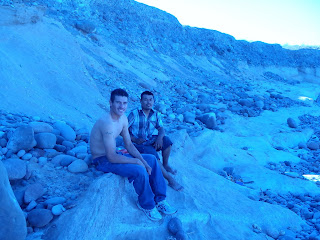
Javiar and Marcos
A Mexican by the name of Javiar introduced himself.  He was with his brother and their families.  He caught some fish and then the wives made ceviche right there which they shared with me.  The sunset that night was breathtaking since the water was so calm.  The horizon turned dark topped by a layer of red and yellow.  The clouds turned to various shades of crimson while the water took on a multicolored sheen that looked like when there is oil in a parking lot puddle but this was all natural.  A swirl of purple, red, and yellow.  I have never really seen water turn colors like this.  I slept that night to the sounds of whales breathing as they passed by the ledge.  One of the most magical outdoor experiences of my life. 
Sunset at Morro el Fraile
     From Santa Rosalia it was a three day paddle down to Bahia Concepcion.  There were small towns along the way.  I also began to see other types of boats besides pangas and Navy gunboats. I started to see lots of sailboats and some commercial fishing trawlers.  The first day out of Santa Rosalia I was driven to shore early by the wind.  The best place to stop was next to a house.  When I went and asked if it was OK to camp they said (In Spanish), "No problem, and do you want some food and beer?".  Turns out that they had a little clam shack restaurant so I got to eat well that night.
Gita's Clam Shack
     The next day I arrived in Punta Chivato which I have been calling the Beverly Hills of Baja.  It is a rich American community.  I stopped at the first house on Shell Beach which is so named due to the thick layer of shells on it.  There I asked the owner, Russ Blackman, if there was someplace where I could find a restaurant, cold beer, and Internet.  He replied that there was no restaurant but that he had plenty of cold beer and Internet.  Once again the Baja Way blew me away.  We hung out all day until after dark.  He even found some white gas for my stove from one of his neighbors.  He had been there for 30 years so he was able to fill me in on the changes that had occurred there over the years.  He had all sorts of information from the history, to wildlife and fishing, and the local gossip.
Russ Blackman

My camp (26) - Punta Chivato
     From Punta Chivato south for the rest of the trip the amount of seabird life dramatically decreased. I have to guess that this had something to do with the increase in commercial fishing that I saw.  Russ said that they even use helicopters to spot the schools of fish.  The amount of stingrays in the water here and continuing into Bahia Concepcion was impressive and a little scary.  I definitely shuffled my feet when I waded in the water to scare them away. 
Whale shark - Bahia Santa Ines
      It was between Punta Chivato and Mulege that I saw a whale shark.  I was short cutting across the bay instead of following the coastline and was about 1 1/2 to 2 miles off shore.  Suddenly there was a double fin (a dorsal fin and a tail fin) sticking out of the water a short distance ahead of me.  It spotted me and came over slowly doing Figure 8's around my boat.  It was about 25 feet long and moved fairly slow but it did come within 6 inches with its tail and it would swim under me.  I sat there for about 20 minutes watching it with my mouth hanging open in amazement.  I knew they were in the Sea of Cortez but I never expected to see one.  This days paddling got me to Mulege and the start of the southern section. 
     In Mulege I took my first full day off.  My camp on the beach was literally next door to the El Patron bar.  Mulege is a scenic town along a river estuary that has been hit hard by hurricanes twice in recent years (2006 and 2009 I think).  It seems to be half Mexican and half American and had an international flavor to it.  I met Mexicans, Americans, Canadians, Germans, and Belgians.  Mulege confirmed to me that if you want to move to Baja then you need to love alcohol and fishing.
Camping next to El Patron bar

Sunset - Mulege


     I had now been paddling for 27 days and had covered 422 miles.
   

Wednesday, May 1, 2013

Norte Cortez - the summary. Part 1 of 3

     20 years ago I read a book called Wind Water Sun by Ed Darack that had incredible color photography and was about his solo kayak journey down the Sea of Cortez.  As soon as I read the book I said that I wanted to do that even though I had never sea kayaked at that point.  After 20 years of talking about it, training for it, and trying to get my act together to do it twice before I finally had everything fall into place and was able to do it.  The following is a summary of the first third of the trip with some of the pictures from along the way.
     I left Seattle with my kayaks on the roof of my truck and a ton of gear in the back on 28 Feb 13. I spent the first week slowly road tripping south visiting friends in Oregon and California eventually arriving at Home Base California in LA belonging to my friends Juli and Morgan who let me leave my truck and a bunch of gear at their house while I was in Mexico.
     Along the way I picked up Toby at LAX who was going to drive down to Mexico with me, drop me off,  and then drive my truck back to Home Base California so it would be safe.  I had never actually met Toby besides phone conversations.  He is a Brit who was a friend of a friend from work they did in Kenya that got connected to me through Facebook.  Toby like me has this drive and need for adventure.  He once rode a motorcycle by himself from Nepal back to England and then a year or two later rode a different motorcycle around the coast of Africa from Egypt to South Africa and then back up to Morocco.  Years ago he lived in Baja for a period of time.  He is currently training to help try to get the first Kenyan woman to the top of Everest.  He heard about my adventure and need for help, thought it sounded like fun, and volunteered to help.  He turned out (as I knew he would be after talking to him on the phone for 5 minutes) to be a great guy and we had a lot of fun swapping stories.  He and I drove into Mexico 2 days later and made it to San Felipe with absolutely no problems. 

     When we got to San Felipe it turned out it was race week for the Baja 250 so the town was full of dune buggies, sand rails, trophy trucks, motorcycles, ATVs, and even the cute little Volkswagon bugs outfitted for the desert.  It was like a scene out of Mad Max/The Road Warrior with all the desert racing machines roaring around.  We drove straight to the beach and I went and touched the Sea of Cortez for the first time.
     We then went to get a beer.  At the first bar we sat down I was instantly introduced to "the Baja Way" of sharing, being hospitable, and helping people out.  The people at the table next to us turned out to be some Canadians (Louise, Mike, Ken, Carol, and their friend Lenny) who live down there part time.  They heard about why we were down there, asked us where we were staying (we didn't know yet), and the next thing we know they invited us to camp out on their property.  This then was upgraded to staying in their guesthouse once we got there.

     Two days later it was time for me to launch off on this expedition.  That morning I had questions of resolve and spirit.  Would I be strong enough and determined enough to pull this off? I know from previous solo efforts that at times your brain is your own worst enemy.  There was also a series of ominous omens that had me a little freaked out that morning.  To start, when we woke up it was raining.  It rarely rains here except during hurricane season. I figured it was the desert and that it would stop by the time we got to the beach and that turned out to be the case.  The next bad omen was when we were taking the boat off the roof of the truck.  Whenever I kayak or am on snow I always wear a pendant around my neck that is the Maori symbol for "Safe Passage Over Water".  As we lifted they kayak the back end swung around hitting me on the chest smashing the pendant into multiple pieces.  I am a bit superstitious so the fact that I broke the pendant with the kayak itself just as I was about to start this adventure was unnerving.  I had a fleeting thought that I shouldn't go but I was way past the point of no return so loaded up the boat anyway.  Then as I am about to start Toby asks "Do you have everything like your passport?".  Oh shit!!!!  My money belt and passport were stashed under the seat in the truck still.  I had almost left without them.  I really was nervous about starting.  It just seemed like too many things were going wrong that morning.  But nevertheless, I pushed the kayak into the water, pointed it south, and left Toby behind on the beach. 


      It didn't take long that first day before I started experiencing the various winds that Baja can throw at you.  That day I learned that if you start seeing a dust storm brewing in the desert then get to shore as fast as you can.  The westerlies are some of the strongest winds here and have blown kayakers out to sea.  Luckily when it hit I was only a few hundred meters off shore and was able to paddle it in.  It was cold that night.  I had to stay completely bundled up in my 32 degree rated sleeping bag.  In the morning when I started paddling the mountains were covered in snow.  I never expected to see snow when I was down here.
     The first 4 days to Puertocitos was a good warm up section.  It was a sandy beach so I could land anywhere with a road following the coast so there were plenty of houses along the way.  It was a safe section of coast to get a feel for the wind, waves, and how the boat was going to handle with such a heavy load.  The landscape consisted of a series of low points that I would have to paddle around.  The waves were always more intense at these points as the water tended to be shallower with a stronger current.  The mountains were set back a distance from the coast.  The rock and mountains would range from red to black with multiple shades of brown all jumbled into a confused geologic mess of uplifted strata with veins of different rock within rock, obvious old lava flows, and large arroyos (dry river beds) cutting through the hills periodically.  The arroyos showed that for such a dry landscape that when it does rain HUGE amounts of water flows over the land.  There was not much vegetation on the hills and what there was consisted of scrub brush, very small trees, and a variety of cactus.  The cactus was predominately cardon (looks like saguaro but bigger), cholla, and nopal (prickly pear).  The bird life was prolific.  Huge flocks of brown pelicans, sea gulls, cormorants, boobies, terns, and frigate birds.  They would often dive into the water all around me catching or attempting to catch fish. I also saw sea lions basking on the beach and in the morning I could see the green eyes of coyotes reflecting in my headlamp.
     Every morning I would get up before dawn so that I could start paddling as soon as the sun came up.  The winds tended to be calm first thing in the morning but by 9 or 10am they would start up.  Those early morning hours were often the nicest paddling of the day.  The other hurdle of this section of coast is the huge tidal exchange. There was a 20 foot difference between high and low tide.  At times it can be even bigger then that.  With the tide cycle where it was I was landing in the afternoon at high tide but it would be low tide when I launched.  That meant I had to drag my kayak and gear sometimes an extra 1/4 mile to reach the water line compared to where it had been when I got to that camp the day before.
     The highlight of Puertocitos was soaking in the hot springs, the "library and post office", and I met some Americans (Rob, Mike, and their sons) who have a house there.  They invited me over that night for dinner and beer.  They are lettuce/alfalfa farmers in Yuma, AZ but spend as much time as they can in Baja fishing.  Puertocitos was otherwise pretty rundown and looked like it had seen better days as did most of Baja. 

      The next section to Gonzaga Bay was similar to the first part but became more remote.  It was also some of the calmest water I saw during the entire trip and it is where I saw my first whales and dolphins.  This section passes through an area called the Enchanted Islands.  Each island in this area has a distinctly different color, size, and seems geologically distinct.  It was here that you find if an island is white it is because it is covered with a frosting of bird guano. It also means that island smells bad. 
     It turned out that when the water was that calm and flat that I had problems.  If there is turbulence in the water I can see where the underwater rocks are.  This section is where I hit my first submerged rock.  It also created a phenomena where the water was so smooth that I would lose my depth perception with it.  My brain would suddenly tell me that I was on a slope of water into a pit and I would get vertigo.  I would have to quickly look to the land horizon to reestablish my stability and I almost capsized a couple of times because of this.  I learned not to stare at the water too hard.


     The next section was the part of the trip that had kept me awake at night worrying about it.  It was a 60 mile section from Punta Final to Punta Remedios nicknamed "The Wall".  For most of this section the cliffs come straight down into the water with few beaches to land on.  It was the most technical section of the trip and a bad place to get caught if the winds picked up.  While I passed through this the winds tended as usual to be calm in the morning and then pick up in the afternoon.  I managed to get through this area without any problems besides being nervous and having anxiety dreams at night that involved snow and avalanches. It however was also on this section that the first of several nights occurred that I could hear whales breathing as I lay sleeping in my tent.  The other wildlife highlight was when sea lions were coming up out of the water and grabbing these cute little grebe seabirds right in front of my kayak for about a 5 minute period of time.  National Geographic kind of stuff happening right in front of me.


     "The Wall" was the most remote section of the entire coastline and I did not expect to see anyone along here.  One day in the middle of the afternoon I was laying in my tent when I heard a different sounding engine noise.  At first I thought it was a plane but then it was too close.  I stuck my head out of the tent to see what it was and to my surprise found a Mexican Navy jetboat/gunboat, the "Albiereo", coming around the corner.  I figured I should wave and say Hi.  They obviously weren't expecting to see anyone either because as soon as they saw me multiple guys started running around and coming out of the bridge.  They instantly turned the boat and brought it in as close inshore as they could which was about 30 yards away.  They then questioned me on who I was and why was I there.  I explained that I was a solo kayaker traveling from San Felipe to La Paz.  That seemed to flabbergast them and I had to tell them 3 different times that there was "no problema".  They finally seemed satisfied and moved on after a bit.
     After getting through "The Wall" that got me to Bahia de Los Angeles which ended the northern section of the trip.  LA Bay is known as the poor mans Galapagos.  It is a bunch of small islands where similar natural selection has occurred as did on the Galapagos.  Animals only miles away from each other have distinct species differences.  There are species of plant and lizard here that are found nowhere else.  It is also a lot easier and cheaper to get to then the Galapagos.  I camped on Isla Ventana before going into town to get food, beer, and supplies.  On Isla Ventana I was treated to a dolphin show right outside my tent that was like something straight out of Sea World.  Dolphins doing front flips in pairs, back  flips, tail pirouettes, and just general dolphin shenanigans.  The hiking on the island was pretty scenic also. 


     When I got to LA Bay my rib cage muscles ached more then anything and my hands had a few minor blisters but I was otherwise holding up.  I had covered 191 miles in 13 days.